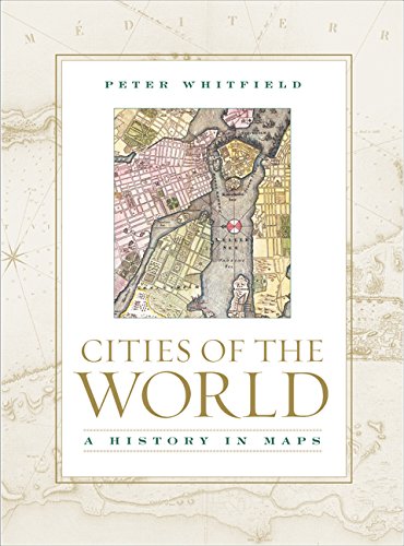
Imagen de portada de Amazon
Imagen de Amazon.com
Imagen de cubierta Syndetics
Portada de Syndetics
Imagen de OpenLibrary

Cities of the World : a history in maps. / Peter Whitfield. txt

Por: London : British Library , 2005Descripción: 1 atlas (208 p.) ill. (some col.) ; col. maps ; 32 cmTipo de contenido:
  • text
Tipo de medio:
  • unmediaded
Tipo de soporte:
  • volume
ISBN:
  • 9780520247253
  • 0520247256 (cloth : alk. paper)
Tema(s): Clasificación CDD:
  • 911 22
Clasificación LoC:
  • G1030 W5 2005
Contenidos:
Contents: Introduction : the city in history -- Teotihuacan, a vanished city -- Alexandria -- Amsterdam -- Athens -- Bath -- Beijing -- Berlin -- Bern and Zurich -- Boston -- Bristol -- Calais -- Cambridge -- Cape Town -- Chicago -- Cologne -- Constantinople -- Cuzco -- Delhi -- Durham -- Edinburgh -- Florence -- Goa -- Helsingor -- Isfahan -- Jerusalem -- Karlsruhe -- Lhasa -- Lisbon -- Liverpool -- London -- Luxembourg -- Manchester -- Mantua -- Marseille -- Mexico City -- Moscow and St. Petersburg (Leningrad) -- Nagasaki -- Naples -- New York -- Oxford -- Palmanova -- Paris -- Philadelphia -- Quebec and New Orleans, the cities of New France -- Rio de Janeiro and Brasilia -- Rome -- Saigon (Ho Chi Minh City) -- St. Andrews -- Salt Lake City -- Salzburg -- San Francisco -- Santo Domingo -- Savannah -- Seville -- Stockholm -- Sydney -- Tangier -- Venice -- Vienna -- Washington -- Würzburg -- Azilia and City of the Sun, unbuilt dream cities --
Resumen: "Cities of the World traces the historic form and special character of the world's greatest cities through a collection of maps and panoramic views. Peter Whitfield focuses on more than sixty cities - from Athens to Brasilia, Washington to Moscow, San Francisco to Saigon, and Venice to Lhasa. He presents an extremely wide range of maps, historic prints, and photographs from many periods that show how the architectural form and the social life of our cities have been shaped - not only by their geographical setting, but also by religion, royal power, commerce, social ideals, and occasionally artistic vision. These images illustrate the historic heart of the cities: the ancient harbors, the hilltop fortresses, the encircling walls, and the houses, churches, and palaces that have been added over the centuries." --
Valoración
    Valoración media: 0.0 (0 votos)
Existencias
Imagen de cubierta Tipo de ítem Biblioteca actual Biblioteca de origen Colección Ubicación en estantería Signatura topográfica Materiales especificados Info Vol URL Copia número Estado Notas Fecha de vencimiento Código de barras Reserva de ítems Prioridad de la cola de reserva de ejemplar Reservas para cursos
Libro CARIBET Biblioteca Arquitectura Colección Oversize CARIBET Oversize G1030 W5 2005 (Navegar estantería(Abre debajo)) 1 Disponible 91000000027409
Total de reservas: 0

Descripciones mejoradas de Syndetics:

Condensing centuries of history into one volume, Cities of the World traces the historic form and special character of the world's greatest cities through a breathtaking collection of maps and panoramic views. Peter Whitfield focuses on more than sixty cities--from Athens to Brasilia, Washington to Moscow, San Francisco to Saigon, and Venice to Lhasa. He presents an extremely wide range of maps, historic prints, and photographs from many periods that show how the architectural form and the social life of our cities have been shaped--not only by their geographical setting, but also by religion, royal power, commerce, social ideals, and occasionally artistic vision. These images illustrate the historic heart of the cities: the ancient harbors, the hilltop fortresses, the encircling walls, and the houses, churches, and palaces that have been added over the centuries. For the armchair traveler or anyone passionate about the history of human civilization, this beautiful, unique book captures the richness of the urban fabric and reflects the collective memory of each metropolis.


Cities of the World demonstrates how the city was linked to the birth and progress of civilization itself, how it has acted as a focus for ideas and technologies, arts and sciences, and even religious devotion. It shows the ways that some cities grew slowly into haphazard, unplanned beauties, while others were shaped by the will of masterful individuals. Whitfield chose the cities featured here not only because they are richly and beautifully illustrated, but also because they demonstrate a notion of spirit--an outward and inward uniqueness.


Many of these historic maps have a pictorial quality that vanished long ago from the functional town-plan. Depicting the classical city-state, the medieval fortress, the baroque capital, and the industrial metropolis, the sumptuous illustrations in this book chronicle how simple outlines found on Babylonian clay tablets evolved into the stylized pictures of medieval times and spectacular bird's-eye panoramic views, finally culminating in the highly functional mass-produced maps of the nineteenth and twentieth centuries. Wonderfully evocative of the places they depict and the artistic tastes of their time, these maps shed new light on civilization itself, with all of its contradictions, shortcomings, energy, and aspirations.


Copub: British Library

Includes index.

Include Bibliography

Contents:
Introduction : the city in history --
Teotihuacan, a vanished city --
Alexandria --
Amsterdam --
Athens --
Bath --
Beijing --
Berlin --
Bern and Zurich --
Boston --
Bristol --
Calais --
Cambridge --
Cape Town --
Chicago --
Cologne --
Constantinople --
Cuzco --
Delhi --
Durham --
Edinburgh --
Florence --
Goa --
Helsingor --
Isfahan --
Jerusalem --
Karlsruhe --
Lhasa --
Lisbon --
Liverpool --
London --
Luxembourg --
Manchester --
Mantua --
Marseille --
Mexico City --
Moscow and St. Petersburg (Leningrad) --
Nagasaki --
Naples --
New York --
Oxford --
Palmanova --
Paris --
Philadelphia --
Quebec and New Orleans, the cities of New France --
Rio de Janeiro and Brasilia --
Rome --
Saigon (Ho Chi Minh City) --
St. Andrews --
Salt Lake City --
Salzburg --
San Francisco --
Santo Domingo --
Savannah --
Seville --
Stockholm --
Sydney --
Tangier --
Venice --
Vienna --
Washington --
Würzburg --
Azilia and City of the Sun, unbuilt dream cities --

"Cities of the World traces the historic form and special character of the world's greatest cities through a collection of maps and panoramic views. Peter Whitfield focuses on more than sixty cities - from Athens to Brasilia, Washington to Moscow, San Francisco to Saigon, and Venice to Lhasa. He presents an extremely wide range of maps, historic prints, and photographs from many periods that show how the architectural form and the social life of our cities have been shaped - not only by their geographical setting, but also by religion, royal power, commerce, social ideals, and occasionally artistic vision. These images illustrate the historic heart of the cities: the ancient harbors, the hilltop fortresses, the encircling walls, and the houses, churches, and palaces that have been added over the centuries." --

Reseñas proporcionadas por Syndetics

Library Journal Review

Whitfield (The Charting of the Oceans) is former director of Stanford University's International Map Centre in London. For this unique book, originally published by the British Library, he has selected 64 cities "not only because they are richly and beautifully illustrated, but also because they demonstrate...an outward and inward uniqueness." Several have been paired for contrast or comparison: Bern and Zurich, Moscow and St. Petersburg, Rio de Janeiro and Brasilia, and Quebec and New Orleans. All the continents are represented, but with 36 of the cities located in Europe, the coverage is somewhat slanted. The city-by-city studies are presented in alphabetical order and introduced by a chapter titled "The City in History" and a glance at the vanished Mexican city of Teotihuac n. The period maps and prints used to illustrate the informative text are mainly from the British Library, but some are from other European and American repositories or private collections. They are beautifully reproduced in color and were carefully chosen for their aesthetic appeal and relevance. The bibliography is general, not city-specific. Recommended for public and academic libraries, particularly those with cartographic or urban studies collections.-Edward K. Werner, St. Lucie Cty. Lib. Syst., Ft. Pierce, Fla. (c) Copyright 2010. Library Journals LLC, a wholly owned subsidiary of Media Source, Inc. No redistribution permitted.

CHOICE Review

Following a rather thorough survey of the history of Western cities, this book presents maps and other images, mostly taken from the collection of the British Library, for 65 cities. European and Anglo-American cities predominate in this collection, since only 15 cities are represented from other regions. As a resource for those interested in historical urban cartography, this book has several serious flaws. First, it fails to provide standard cartobibliographic data such as map size, medium, and cartographer. More importantly, maps and images for most cities seem to have been randomly chosen, as they do not necessarily represent the oldest, rarest, or best maps available. Furthermore, the book fails to provide a chronological retrospective of urban evolution, since most cities are represented by only one map. Thus, the book portrays most of its cities through maps providing disconnected, randomly chosen snapshots in time. Nicely bound, relatively inexpensive, and filled with many good color graphics, this makes a fine coffee-table book. It will be more interesting to casual readers than cartographic scholars. ^BSumming Up: Optional. General collections/public libraries. B. C. Pearson University of Central Arkansas

Booklist Review

In this collection of historical maps of about 60 cities, Whitfield, an eminent historian of cartography, yields much insight about how cities have perceived themselves. The maps themselves, which date from the Renaissance to the Victorian era, generally come in two forms: the perspective, or bird's-eye view, and the scaled map, an attempt at exact measurement of a city's streets and landmarks. One of Whitfield's themes is the idealization of a city that maps of these types induced. When given a pictorial representation of a city, viewers could imagine how to improve it aesthetically. This was the express purpose of maps of planned cities such as Washington, D.C. Capturing the civic spirit is another purpose explored by Whitfield; in his compact city histories, he dwells on a place's origin as a fortress (such as Luxembourg and Quebec) or as a commercial center (Amsterdam and New York). Selecting cities from around the world, Whitfield promotes certain browsing of nearly 150 colorful and beautifully reproduced historical charts. --Gilbert Taylor Copyright 2005 Booklist

Notas de autor provistas por Syndetics

Peter Whitfield is an independent scholar and a leading expert in map history and exploration. He is a former director of Stanford's International Map Centre in London. His previous books include The Image of the World (1994), The Mapping of the Heavens (1995), The Charting of the Oceans (1996), New Found Lands (1998), Landmarks in Western Science (1999), Astrology: A History (2001), and Sir Francis Drake (2004).
Compartir
logopucpr-y-vive

Contáctanos

¡Queremos saber de ti!

Tel. 787.841.2000 Ext. 1801

bibliotecavaldes@pucpr.edu

⁣Búscanos en las redes

© 2026 Desarrollado por Ignite Online • All Rights Reserved • Powered by Koha.