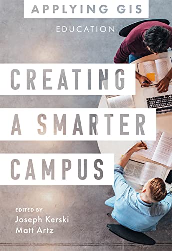

Creating a smarter campus : GIS for education / Edited by Joseph J. Kerski [and] Matt Artz.
Idioma: Inglés Series Applying GISEditor: Redlands, California : Esri Press, 2022Descripción: xii, 154 pages : color illustrations, color maps ; 21 cmTipo de contenido:- text
- unmediated
- volume
- 9781589487376
- 23 378.1
| Imagen de cubierta | Tipo de ítem | Biblioteca actual | Biblioteca de origen | Colección | Ubicación en estantería | Signatura topográfica | Materiales especificados | Info Vol | URL | Copia número | Estado | Notas | Fecha de vencimiento | Código de barras | Reserva de ítems | Prioridad de la cola de reserva de ejemplar | Reservas para cursos | |
|---|---|---|---|---|---|---|---|---|---|---|---|---|---|---|---|---|---|---|
| Libro | Biblioteca Encarnación Valdés Colección General bev | 378.1 C9122 (Navegar estantería(Abre debajo)) | Disponible | 80000002642638 |
Descripciones mejoradas de Syndetics:
Discover how educators, researchers, IT support, and administrators can transform education inside and out, now and for the future.
Geographic information system (GIS) technology offers a powerful decision-making tool in various aspects of education. It gives educators a new opportunity to teach problem-solving to a tech-savvy generation of learners. Researchers can use GIS for data visualization and integration, and IT professionals can improve the offerings of their cloud-based platforms. GIS offers administrators a way to visualize and manage everything from mapping campus buildings to planning where and when to close schools and open new ones.
Creating a Smarter Campus: GIS for Education explores a collection of real-life stories about education organizations doing just that with GIS. Through their ideas, plans, and goals, they help readers understand how to use GIS and integrate spatial reasoning into teaching, research, and management. A "next steps" section provides ideas, strategies, tools, and actions to help you jump-start using GIS for education. A collection of online resources, including additional stories, videos, new ideas and concepts, and downloadable tools and content, complements this book.
Edited by Joseph Kerski, education manager at Esri, and Matt Artz, an Esri content strategist.
Includes bibliographical references.
Part 1. Educators
Part 2. Researchers
Part 3. IT support
Part 4. Administrators
"Discover the geography approach to improving teaching, learning, research, and administration. Creating a Smarter Campus: GIS for Education explores a collection of real-life stories about education organizations successfully using GIS technology to improve teaching, learning, research, and administration. The book also includes a section on next steps that provides ideas, strategies, tools, and actions to help jump-start your own use of GIS for education. A collection of online resources, including additional stories, videos, new ideas and concepts, and downloadable tools and content, complements this book"-- Provided by publisher.
Tabla de contenidos provista por Syndetics
- Introduction(p. ix)
- How to use this book(p. xiii)
- Part 1 Educators(p. 1)
- GIS project helps with food insecurity and waste(p. 3)
- Palomar College
- Mapping for equity and environmental justice(p. 8)
- Equity Research Institute, University of Southern California
- Building a geospatial legacy(p. 12)
- Swiss Federal Institute of Technology
- Students map ingenious route to clean water(p. 18)
- Saaf wafer
- Students see opportunities for community growth(p. 23)
- Perm State University
- Making GIS a statewide initiative(p. 28)
- West Virginia Department of Education
- High school helps students expand their analytic capabilities(p. 31)
- Loudoun Valley High School
- Part 2 Researchers(p. 39)
- Serious game play(p. 41)
- Rochester Institute of Technology
- Communities see how land-use changes may affect local water quality(p. 49)
- Tipping Point Planner Program
- Evaluating tobacco use on a tobacco-free campus(p. 56)
- University of South Carolina
- Geospatial brainpower: Research on spatial reasoning(p. 60)
- The Geospatial Semester at James Madison University
- GIS and ancient trees reveal past temperatures and climate change(p. 67)
- University of Arizona's Laboratory of Tree-Ring Research and Western Washington University
- Mapping pikas' habitat to help save them(p. 73)
- Nevada Department of Wildlife; University of Nevada, Reno; and San José State University
- Part 3 It Support(p. 79)
- University inspires campus-wide GIS use(p. 81)
- Clemson Center for Geospatial Technologies
- University makes GIS accessible across campus(p. 89)
- University of California Son Diego
- Mapping without boundaries: GIS reaches across university and beyond(p. 93)
- Colorado State University
- Scaling up GIS across campus(p. 99)
- University of Michigan
- University empowers campus-wide GIS(p. 102)
- HAS University of Applied Sciences
- Part 4 Administrators(p. 107)
- School district integrates CAD and GIS for planning(p. 109)
- Albuquerque Public Schools
- Online schooling prompts municipalities to map digital inequities(p. 114)
- Philadelphia and Palm Beach School Districts
- University uses GIS to rethink campus litter management(p. 120)
- Michigan State University
- New university campus incorporates GIS from the outset(p. 128)
- Sabah Al-Salem University City - Kuwait University
- GIS improves estate management(p. 133)
- University of Cambridge
- It's in the wastewater: Sensing and mapping COVID-19(p. 137)
- University of California San Diego
- Crowdsourcing a university's facilities mapping(p. 142)
- Washington State University
- Next Steps(p. 148)
- Contributors(p. 155)