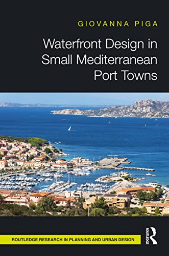

Waterfront design in small Mediterranean port towns. / Giovanna Piga. txt
Series Routledge research in planning and urban designEditor: Abingdon, Oxon ; New York, NY : Routledge, 2022Descripción: xviii, 244 p. : ill. ; photo. ; maps ; plans ; 25 cmTipo de contenido:- text
- unmediated
- volume
- 9780367516239
- 9780367516260
- Waterfronts -- Mediterranean Region -- Planning
- Waterfronts -- Italy -- Sardinia -- Planning
- Tourism and city planning -- Mediterranean Region
- Tourism and city planning -- Italy -- Sardinia
- Port cities -- Mediterranean Region
- Port cities -- Italy -- Sardinia
- Small cities -- Mediterranean Region
- Small cities -- Italy -- Sardinia
- 23 720.9182/2
- NA9053.W38 P54 2022
| Imagen de cubierta | Tipo de ítem | Biblioteca actual | Biblioteca de origen | Colección | Ubicación en estantería | Signatura topográfica | Materiales especificados | Info Vol | URL | Copia número | Estado | Notas | Fecha de vencimiento | Código de barras | Reserva de ítems | Prioridad de la cola de reserva de ejemplar | Reservas para cursos | |
|---|---|---|---|---|---|---|---|---|---|---|---|---|---|---|---|---|---|---|
| Libro | CARIBET Biblioteca Arquitectura Colección General CARIBET | General NA9053.W38 P54 2022 (Navegar estantería(Abre debajo)) | 1 | Disponible | 91000000068007 |
Descripciones mejoradas de Syndetics:
This book addresses issues that waterfronts face in small Mediterranean port towns due to increases in the tourism industry. Integrating theory and pragmatic approaches, Waterfront Design in Small Port Towns proposes a design matrix which can go on to be implemented in waterfronts globally.
The demand for a sustainable regeneration of the urban waterfront is constantly growing and represents the ultimate challenge to preserve and value the uniqueness of the region and to activate an overall redevelopment of small port towns. To understand these issues, Waterfront Design in Small Port Towns contains an in-depth investigation of the cultural and environmental assets and spatial socio-economic factors of the urban waterfront. This is conducted through the author's original methodological framework, the Waterfront Design Matrix, which responds to the specific scales and idiosyncrasies of the archetypical waterfront.
The methodological and theoretical approach developed in the book can be applied to different geographical locations and countries, presenting comparable characteristics. This book is an ideal read for professionals and students alike with an interest in urban design and planning.
Includes bibliographical references and index.
The archetypical waterfront : role and prospect of small port towns in the southern European Mediterranean region --
Devising the 'waterfront design matrix' --
The establishment and transformation of the urban waterfront in northeast Sardinia --
The pilot area : waterfront phenomenon in northeast Sardinia --
Reflections --
Figures:
3.1 Typical northeast Sardinia landscapes: --
1. sand dunes and Mediterranean maquis; --
2. granitic boulders and prickly pears; --
3. Palau Vecchio beach --
3.2 Typical northeast Sardinia farmhouse (stazzo) --
4.1 Santa Teresa Gallura pictorial description and identification of the waterfront zones --
4.2 Maritime resources: view of the Commercial Port (Zone 2) and Tarra Ecchja (Zone 5 and Zone b) from the town --
4.3 Maritime resources: Tanca La Marina (Zone 3) and La Marina (Zone 4) --
4.4 Maritime resources: the entrance of the harbour with the Commercial Port (Zone 2) to the left and Tarra Ecchja (Zone 5) to the right --
4.5 Architectural resources: Longone Watchtower --
4.6 Architectural resources: Piazza Vittorio Emanuele I --
4.7 Environmental resources: Rena Bianca beach and Isola Municca --
4.8 Environmental resources: Capo Testa Lighthouse --
4.9 La Maddalena pictorial description and identification of the waterfront zones --
4.10 Maritime resources: view of the commercial dock Banchina Zonza (Zone 2) --
4.11 Maritime resources: Cala Gavetta (Zone 1) --
4.12 Maritime resources: Banchina Medaglie d'Oro (Zone 2) --
4.13 Architectural resources: historic houses at Cala Gavetta quay (Zone 1) --
4.14 Environmental resources: spectacular granite boulders --
4.15 Urban frontage: Banchina della Posta --
4.16 Link town-waterfront: transverse pedestrian links high street to waterfront --
4.17 Palau, granite outcrop formation: Capo d'Orso geomorphosite --
4.18 Palau pictorial description and identification of the waterfront zones --
4.19 Maritime resources: Commercial Port and Marina --
4.20 Maritime resources: wharf for small boats (Zone 2) --
4.21 Maritime resources: Commercial Port and Passenger Terminal (Zone 2) --
4.22 Maritime resources: view of the harbour from Baragge hill --
4.23 Architectural resources: Palazzo and Piazza Fresi, the house of the founder Giandomenico Fresi, 1875 --
4.24 Architectural resources: lighthouse at Punta Palau (Zone a) --
4.25 Urban frontage: front row frontage overlooking the railway tracks at the Commercial Port (Zone 2) --
5.1 Palau: key map with section lines and sections cut across the Six Urban Zones of the waterfront
Maps:
0.1 The island of Sardinia and the location of the three port towns of Santa Teresa Gallura, La Maddalena and Palau along the northeastern coast --
3.1 Santa Teresa Gallura masterplan, 1807 --
3.2 Santa Teresa Gallura map of the town and region, 1848 --
3.3 La Maddalena ed Isole Intermedie map, 1849 --
3.4 Palau map, 1920 --
4.1 Santa Teresa Gallura location and topographic features --
4.2 Santa Teresa Gallura urban growth from 1954 to 2010 --
4.3 Santa Teresa Gallura development of the town from 1968 to 2019 --
4.4 Santa Teresa Gallura spatial structure and infrastructure network --
4.5 Santa Teresa Gallura Waterfront Identity — cultural and environmental heritage --
4.6 Santa Teresa Gallura Waterfront Permeability — urban and natural boundary --
4.7 Santa Teresa Gallura Waterfront Dynamics — direct access and link town—waterfront --
4.8 La Maddalena location and topographic features --
4.9 La Maddalena urban growth from 1954 to 2010 --
4.10 La Maddalena development of the town from 1968 to 2019 --
4.11 La Maddalena spatial structure and infrastructure network --
4.12 La Maddalena Waterfront Identity — cultural and environmental heritage --
4.13 La Maddalena Waterfront Permeability — urban and natural boundary --
4.14 La Maddalena Waterfront Dynamics — direct access and link town—waterfront --
4.15 Palau location and topographic features --
4.16 Palau urban growth from 1954 to 2010 --
4.17 Palau development of the town from 1968 to 2019 --
4.18 Palau spatial structure and infrastructure network --
4.19 Palau Waterfront Identity - cultural and environmental heritage --
4.20 Palau Waterfront Permeability - urban and natural boundary --
4.21 Palau Waterfront Dynamics - direct access and link town-waterfront --
5.1 Palau: Permeability of the boundary influencing Dynamics
"This book addresses issues that waterfronts face in small Mediterranean port towns due to the increase in the tourism industry. Integrating theory and pragmatic approaches, Waterfront Design in Small Port Towns proposes a design matrix which can go on to be implemented to waterfronts globally. The demand for a sustainable regeneration of the urban waterfront is constantly growing and represents the ultimate challenge to preserve and value the uniqueness of the region and to activate an overall redevelopment of small port towns. To understand these issues, Waterfront Design in Small Port Towns contains an in-depth investigation of the cultural and environmental assets and spatial socio-economic factors of the urban waterfront. This is conducted through the author's original methodological framework, the Waterfront Design Matrix, which responds to the specific scales and idiosyncrasies of the archetypical waterfront. The methodological and theoretical approach developed in the book can be applied to different geographical locations and countries, presenting comparable characteristics. This book is an ideal read for professionals and students alike with an interest in urban design and planning"--
Notas de autor provistas por Syndetics
Giovanna Pigais a Lecturer in Architecture at Coventry University, UK, and a registered architect.