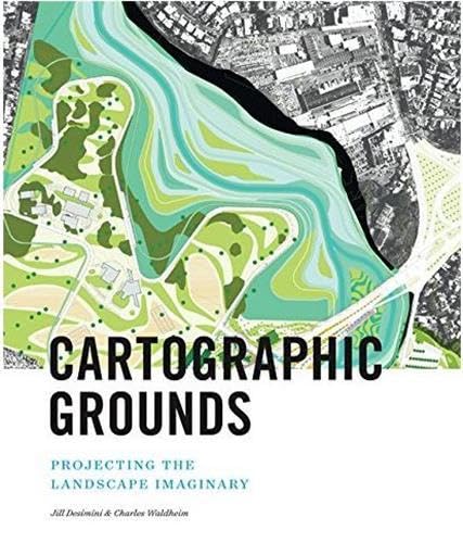

Cartographic grounds : projecting the landscape imaginary. / Jil Desimini & Charles Waldheim. txt
Editor: China : Princeton Architectural Press , 2016Descripción: 271 p. ill.; mapa.; col. ; 28 cmTipo de contenido:- text
- unmediated
- volume
- 9781616893293
- 526 23
- GA102.3 C368 2016
| Imagen de cubierta | Tipo de ítem | Biblioteca actual | Biblioteca de origen | Colección | Ubicación en estantería | Signatura topográfica | Materiales especificados | Info Vol | URL | Copia número | Estado | Notas | Fecha de vencimiento | Código de barras | Reserva de ítems | Prioridad de la cola de reserva de ejemplar | Reservas para cursos | |
|---|---|---|---|---|---|---|---|---|---|---|---|---|---|---|---|---|---|---|
| Libro | CARIBET Biblioteca Arquitectura Colección General CARIBET | General GA102.3 C368 2016 (Navegar estantería(Abre debajo)) | 1 | Disponible | 91000000052415 |
Descripciones mejoradas de Syndetics:
Mapping has been one of the most fertile areas of exploration for architecture and landscape in the past few decades. While documenting this shift in representation from the material and physical description toward the depiction of the unseen and often immaterial, Cartographic Grounds takes a critical view toward the current use of data mapping and visualization and calls for a return to traditional cartographic techniques to reimagine the manifestation and manipulation of the ground itself.
Each of the ten chapters focuses on a single cartographic technique--sounding/spot elevation, isobath/contour, hachure/hatch, shaded relief, land classification, figure-ground, stratigraphic column, cross-section, line symbol, conventional sign--and illustrates it through beautiful maps and plans from notable designers and cartographers throughout history, from Leonardo da Vinci to James Corner Field Operations. Mohsen Mostafavi, dean of the Harvard Graduate School of Design, introduces the book.
Include index.
Table of contents:
Foreword / Mohsen Mostafavi --
Introduction: Projecting the landscape imaginary --
Notes on scale --
Sounding / spot elevation --
Isobath / contour --
Hachure / hatch --
Shaded relief --
Land classification --
Figure ground --
Stratigraphic column --
Cross section --
Line symbol --
Conventional sign --
Afterword / Antoine Picon --
References --
Credits --
Index --
Acknowledgments --
"Mapping has been one of the most fertile areas of exploration for architecture and landscape in the past few decades. While celebrating this shift in representation from the material and physical description toward the depiction of the unseen and often immaterial, Cartographic Grounds takes a critical view toward the current use of data mapping and visualization and calls for a return to traditional cartographic techniques to reimagine the manifestation and manipulation of the ground itself. Each of the ten chapters focuses on a single cartographic technique--sounding/ spot elevation, isobath/contour, hachure/hatch, shaded relief, land classification, figure-ground, stratigraphic column, cross-section, line symbol, conventional sign-- and illustrates it through beautiful maps and plans from notable designers and cartographers throughout history, from Leonardo da Vinci to James Corner Field Operations. Mohsen Mostafavi, dean of the Harvard Graduate School of Design, introduces the book, a veritable atlas of contemporary maps and techniques that is as beautiful as it is useful"--
Reseñas proporcionadas por Syndetics
Library Journal Review
Cartographers both ancient and modern share a similar challenge: depicting three-dimensional space on paper. Over time, the means for doing this have certainly changed, but maps produced then and now utilize the same "foundational representational techniques," note Harvard University professors Desimini (landscape architecture) and Waldheim (John E. Irving Professor of Landscape Architecture). Their beautifully realized title depicts these methods-the use of isobaths, crosshatching, and land classification, for example, with high-quality, color reproductions from all over the world illustrating how today's design innovations can produce stunning results (the book also includes some older maps and map sections). Bonuses include historical and social commentary found in the introduction, essays opening each chapter, and alongside the maps. "Notes on Scale," for instance, informs readers that "this level of detail is a privilege.... There is, and always has been, a correlation between power and the availability of geospatial data." VERDICT Succinct, well-written notes on mapping basics, and the gorgeous examples employed, make this a must for academic geography, cartography, and design collections.-Henrietta Verma, formerly with Library Journal © Copyright 2016. Library Journals LLC, a wholly owned subsidiary of Media Source, Inc. No redistribution permitted.Notas de autor provistas por Syndetics
Charles Waldheim is the principal of Urban Agency in Cambridge, MA, and the John E. Irving professor of landscape architecture at Harvard University Graduate School of Design. He is the author of PAPress's Landscape Urbanism Reader.Jill Desimini is an assistant professor of landscape architecture at Harvard University Graduate School of Design.